Background
Ecological surveys are often inaccurate due to the inherent bias in current techniques used, forcing environmental scientists to look for other means in which to conduct fauna surveys (Guisan et al. 2005). Since many decisions for wildlife conservation are based on such surveys, it is important that new, more accurate methods be developed. Species distribution modelling (SDM) has been proposed as one such method to improve accuracy (Araujo et al. 2006), however as the modelling techniques are applied on already biased data, the root issue of bias is still not adequately addressed.
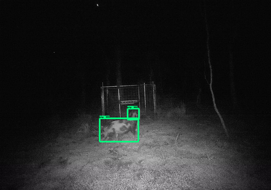
Recent advances in machine learning (ML) techniques offer promising approaches to address these underlying problems. ML research focuses on algorithms, patterns and models to generate outputs based on previously observed inputs (training data). It has been widely used across industries ranging from medical imagery, speech recognition and recently to detect animals from wildlife images. Typically, this is done on high power computers needed to run complex ML models that not only provide predictions but also confidence metrics of that prediction. Recent advances in the ML field suggest that these algorithms could be run on embedded (low power) battery operated devices (Jacob et al. 2018), offering the potential to apply image classification on the video stream of a low power embedded device. Such classifications could then be reported, providing a new continuous ecological survey method without the spatial and temporal biases of current techniques.
Aims
- To develop a battery powered embedded system that can continuously analyse a video stream for detection of animals
- Classify any detected animals in real time and send the classification over low power wireless communications
- Provide a comparison of this new approach to current techniques
Methodology
Staff and students at the Hidden Vale Wildlife Centre have conducted research using pitfall, Elliott and cage trap surveys for many years at the Old Hidden Vale property providing a rich baseline of data to benchmark new methods of surveying. The first experiment will target Fat-tailed dunnarts Sminthopsis crassicaudata, initially (and then house mice Mus musculus, both in captive colonies), to develop the individual animal recognition algorithms; other vertebrate species will be tested in the field.
The first step will be to acquire multiple images of dunnarts in different lighting and environmental conditions using the camera hardware of the proposed solution. The photos will form the foundation for the machine learning algorithm to train from. Once new ML models are generated, they will be compressed using a quantisation technique so that the model is suitable for the embedded device deployment.
The device housing the model will be deployed along a drift fence in place of the traditional buried bucket. As animals walk through the gaps in the fence into the devices field of view, the technology will classify what it is seeing in the current view. Once classified the results will be sent back through a long-range low power radio to enable a count to be stored. A traditional trail camera will be attached to the new devices to determine their accuracy.

Expected outcomes
This research aims to design and evaluate a continuous vision-based biodiversity survey system using embedded machine learning. To overcome the inherent bias of traditional trapping methods, this approach will attempt to provide finer spatial and temporal resolution with reduced labour and equipment costs.
References
Benoit Jacob et al, 2018 ‘Quantization and Training of Neural Networks for Efficient Integer- Arithmetic-Only Inference’, Proceedings of the IEEE Computer Society Conference on Computer Vision and Pattern Recognition, pp. 2704-2713.
Antoine Guisan & Wilfried Thuiller, 2005, ‘Predicting species distribution: Offering more than simple habitat models’, Ecology Letters vol. 8, no. 9, pp. 993-1009.
Miguel B. Araujo & Antoine Guisan, 2006. ‘Five (or so) challenges for species distribution modelling’, Journal of Biogeography vol. 33. no. 10, pp. 1677-1688.
Acknowledgements
Commonwealth Scientific Industrial Research Organisation


